Air Traffic Control
ERIS-A
ERIS-A belongs to a family of Advanced Surface Movement Guidance and Control System designed for air traffic control and safety support on the airport movement area (runways/taxiways) and in its immediate adjacent airspace, enhancing ground operations under all visibility conditions, developed in compliance with ICAO 9830-AN/452, EUROCAE ED-87 and ED-109 regulations.
ABOUT ERIS-A
Description
ERIS-A (ERIS Airport Control System) is designed for air traffic control and safety support on the airport movement area (runways/taxiways) and in its immediate adjacent airspace. ERIS-A is a joint development of R-SYS and ERA and complies with ICAO and EUROCONTROL standards related to ATM systems.
The ATC controllers are provided with integrated air/ground operational picture of the controlled area supplemented by aeronautical and meteorological information, and tools for traffic control, SAFETY NET system.
Benefits
Complex airport management service
Modular architecture
Easy integration into the existing enviroment
Open architecture
Central and dynamic configuration
ABOUT ERIS-A
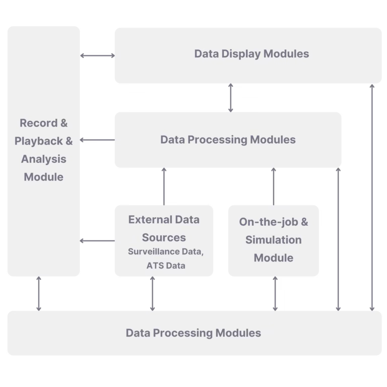
System architecture
Structure
System features
Key Components
Description
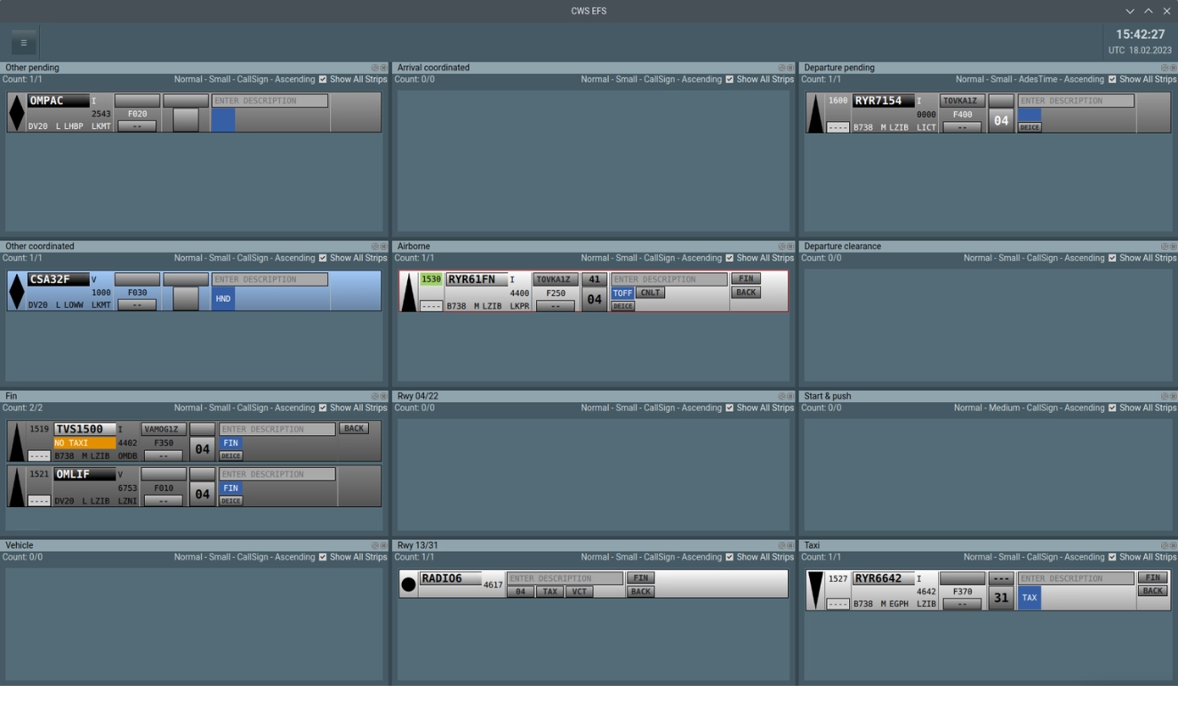
The Controller Working Position (Collaborative Workstation, CWS) application can run in a single- or dual-monitor configuration while providing the same functions.
User profile management provides access control based on rules specified by the user. Map view profile management allows to apply user-specific settings to create customized configurations of map content which the user needs when accomplishing his specific tasks.
Description
EFS module provides the user with a set of customized predictive clearances to be issued with respect to operational and safety aspects, local rules, and applied to a specific phase/type of flight or flight operation.
In a dual-monitor configuration, the main screen is used to display surveillance and SafetyNet information while providing the controller with a clear picture of movements on approach and on the airport surface and the second screen serves for a display of EFS assisting users in managing traffic workflows safely and efficiently on the ground and on approach.
In a single-monitor configuration, both the surveillance functions and EFS system are manipulated via one screen whereby specific groups of strips are managed through windows laying on top of the main primary CWS window.
Description
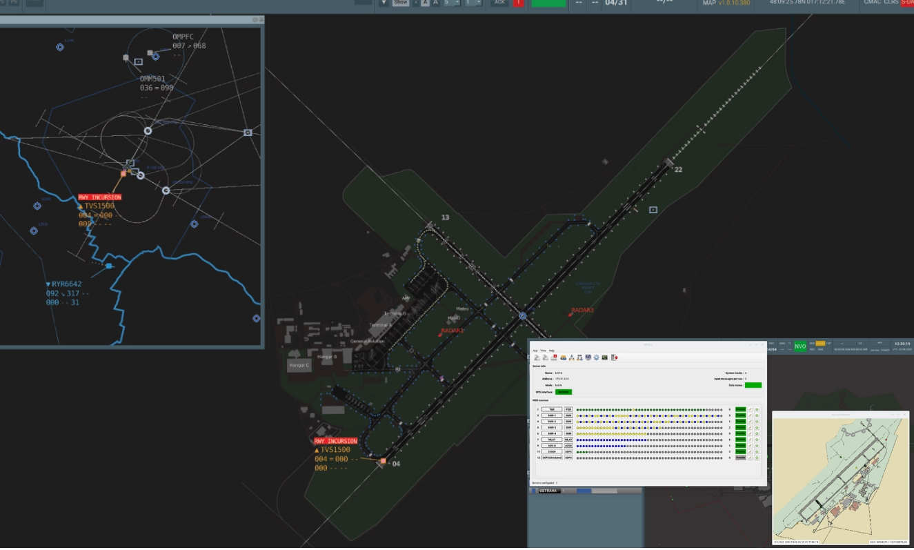
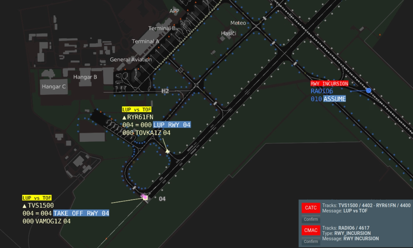
RMCA, CATC and CMAC are an integral part of Airport Safety Nets contributing to a safety of airside operation through a prevention of hazardous situations and/or accidents resulting from operational errors or deviations of a controller, flight crew or vehicle driver.
Calculation of conflict events is performed by a centralized service ensuring that identical conflicts and alerts are presented on all CWS screens. Conflicts/alerts are distributed to CWS workstations by ASTERIX Cat. 04 protocol.
Description
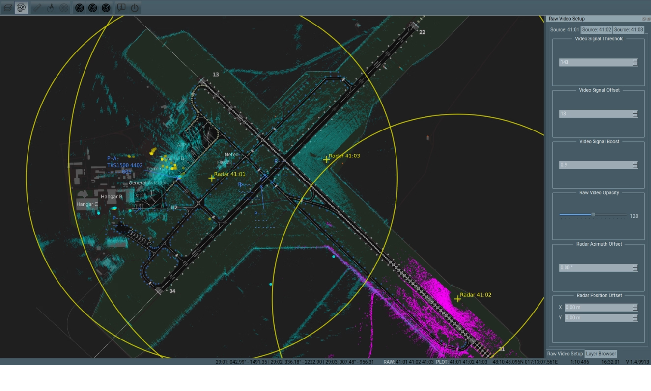
Surveillance subsystem is an integral part of ERIS-A solution. ERIS can be integrated with standard SMR radar via ASTERIX CAT 10 output, however R-SYS introduced an optional cost-effective solution in accordance with upcoming A-SMGCS Light concept which is designed for middle-sized and regional airports. This solution uses reasonably priced EHF radar combined with ERA ADS-B or MLAT system for a detection of both cooperative and non-cooperative targets.
EHF is a short-range radar providing high-precision measurement of a target position. It can be used as a principal source of non-cooperative target data or as a gap filler radar ensuring a coverage of blind zones. EHF radars are sources of sufficient data needed for a calculation of potential collisions caused by runway incursion.