CGSS is a cost effective advanced surveillance data processing system designed to detect and track air/ground vehicles and persons over the airport operational areas on small and middle-sized airports. It has been developed in compliance with ICAO and EUROCONTROL standards to provide the controllers with integrated air and ground picture within defined area. In addition, it conveys aeronautical and meteorological information, and offers tools for aircraft vectoring and Airport Safety Net tools.
Key functions:
- Detection of cooperative and non-cooperative mobiles ground movement within operational airport areas
- Airport Safety Net
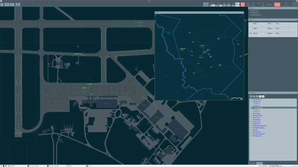
- Traffic context picture – data fusion coming from surveillance data sources
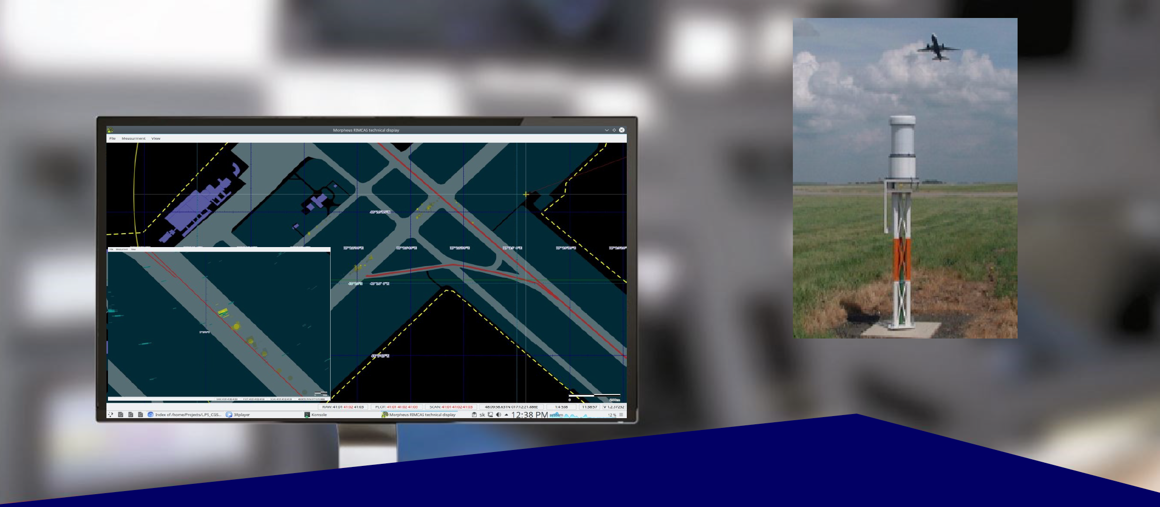
- Controlled traffic video presentation to shorten ATCO response time in case of safety warnings, to reduce false alarm rate, or to provide additional identification
CGSS technology employs a variety of sensors to determine target parameters in order to:
- Get performance parameters comparable with that of A-SMGSC, Level 2 under the conditions of limited surveillance capability with acceptable false alarm rate
- Provide airport control service on operational and maneuvering surfaces using Surveillance Systems with limited capability,
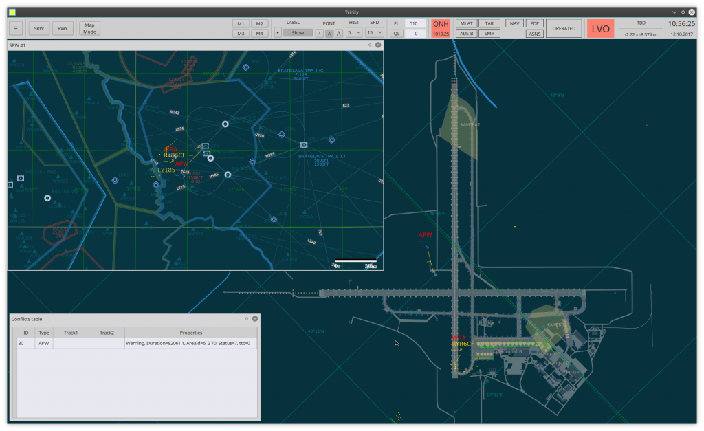
- Provide Runway Incursion Monitoring and Collision Avoidance System – detection and tracking of conflict events that may result from a breach of permitted separation minima between moving objects (departing/arriving aircraft, ground vehicles, unauthorized unknown objects). Parameter values of the conflict calculation are set up based on the airport layout as well as current values of NVO, LVO.
- Present surveillance data output and aeronautical information coming from available data sources
CGSS increases air and ground traffic safety in multiple ways even in marginal weather and surveillance conditions where it helps to:
- Control aircraft take-off and landings in times of unbalanced increase of traffic density,
- Warn controllers of deviations from aircraft/vehicle ground movement path,
- Mitigate safety risks caused by an incursion of operational airport areas and/or failure to keep a required separation between mobiles.
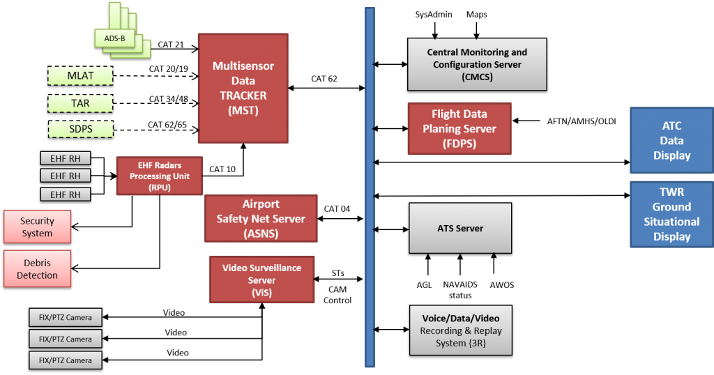
CGSS processes data coming from the following multiple surveillance sources by continuously checking input data integrity and data quality, non-intrusive input data splitting, mono-sensor tracking , multi-sensor data fusion and full redundancy support:
- EHF Radar Network
- ADS-B Receivers
- TAR
- MLAT
- External Surveillance Data Processing System (EHF Radars Processing Unit, Multi-sensor Data Fusion Unit, Video Surveillance Control System)
CGSS Safety Net Server provides warnings and alerts within a controlled area in case conditions for conflict occurrence are fulfilled, both as short term conflict warnings (Minimum Safe Altitude Warning, Area Proximity Warning, Route Adherence Monitor) and Runway Incursion Monitoring and Conflict Alerts (RMCA) such as approaching/arriving aircraft, obstacles on RWY, departing aircraft crossing, stop bar crossing, incursion in restricted area, vehicle on RWY or safety strip, opposite traffic alert, arrivals/departures to wrong RWY or intersecting RWYs.